 Filter: Categories of Wisconsin Historical Images
Filter: Creator Name of Clason Map Co
Filter: Categories of Wisconsin Historical Images
Filter: Creator Name of Clason Map Co
| Date: | 1926 |
|---|---|
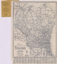
| Description: | This map shows paved roads, highways, road distances, cities, lakes, rivers, and county boundaries. Included are portions of Minnesota, Iowa, and Michigan.... |

| Date: | 1915 |
|---|---|
| Description: | This map displays various automobile routes through the state of Wisconsin and parts of Illinois, Iowa, Minnesota, and Michigan. Cities, counties, Lake Mic... |
If you didn't find the material you searched for, our Library Reference Staff can help.
Call our reference desk at 608-264-6535 or email us at: